Drone Interface for surveillance and capture of poachers.
Watch Demo Video:
Problem
Wildlife reserves have limited staff and resources, making it nearly impossible for them to catch poachers in the act or at all. With reserves ranging in size from 300 - 32,000 square miles, rangers face significant difficulties attempting to respond to incidents thousands of miles apart.
Wildlife reserves and conservation efforts exist that leverage drone video technology for real-time surveillance of park grounds. However, the existing solutions are limited by:
Need for rangers / users to review and analyze footage
Time-consuming tasks of manually identifying park borders, distinguishing wildlife, and accessing up-to-date information on poachers at large.
How can we help rangers to comprehensively monitor their parks, and to respond quickly and effectively to incidents in collaboration with law enforcement?
Solution
After conducting some initial research, I determined that a drone equipped with augmented reality (AR) technology and geographic information system (GIS) technology would be an ideal solution to this problem.
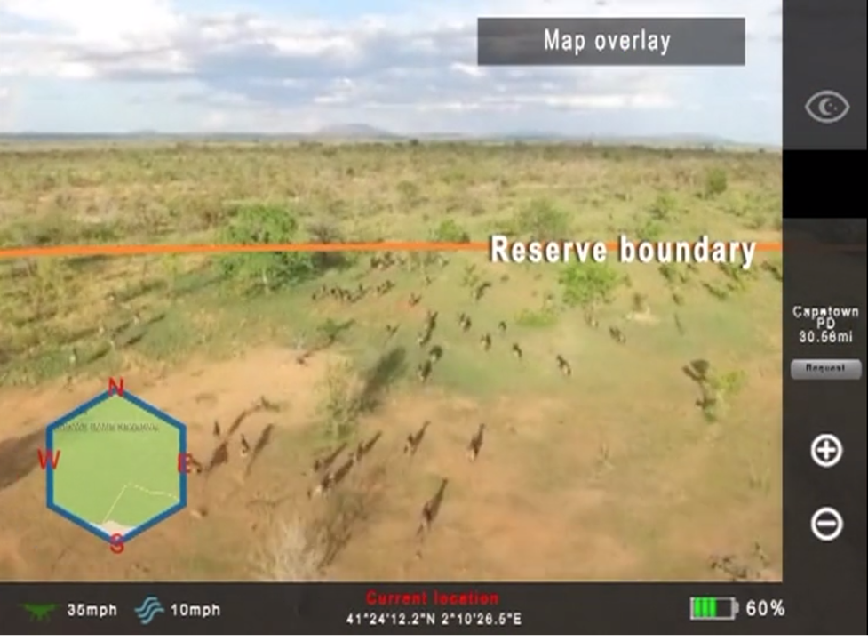
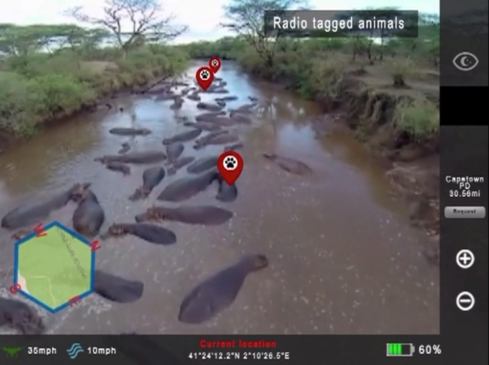
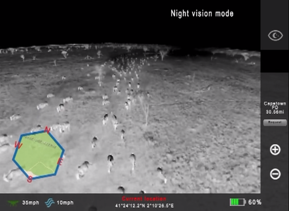
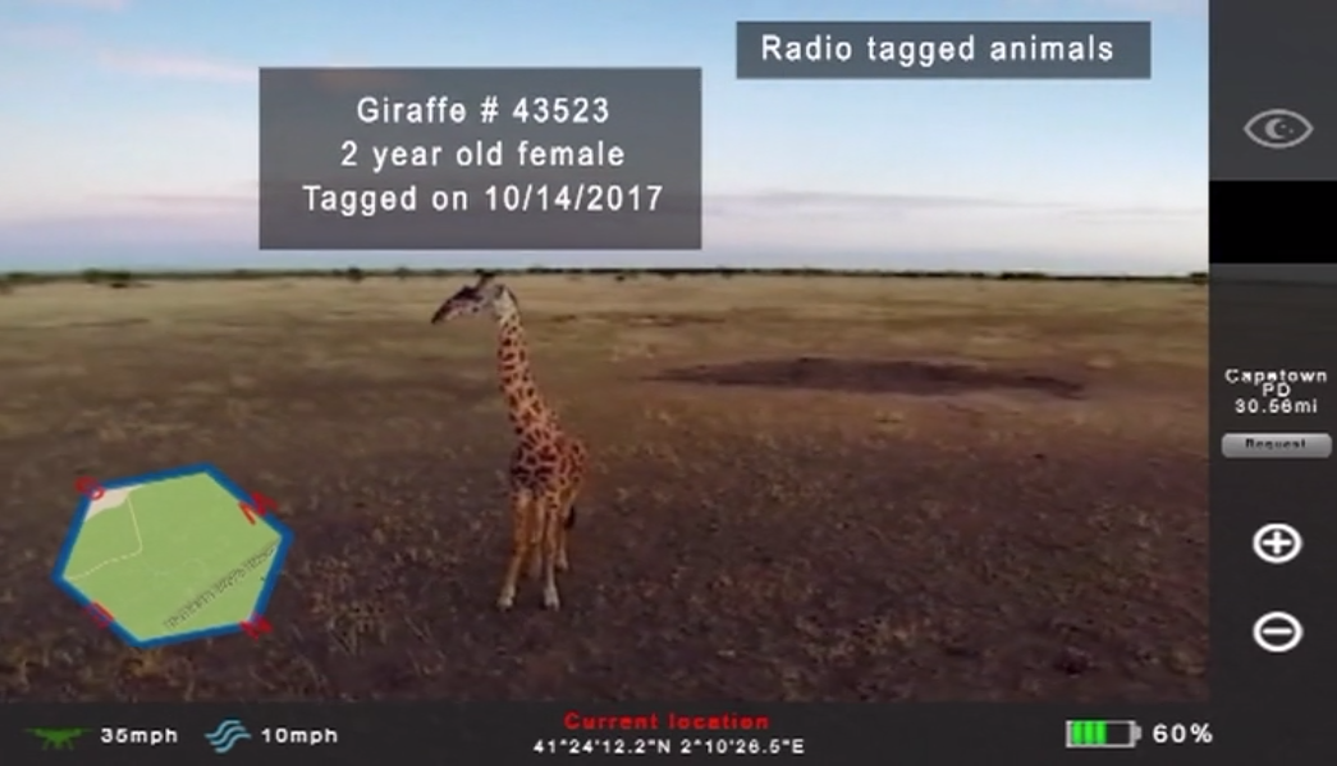
An AR solution with GIS capabilities would allow rangers to quickly scan park lands while receiving vital information on park boundaries, facial recognition, and vehicle identification. This would greatly increase the amount of miles that rangers are able to patrol in one day and allow for more efficient and effective intervention by rangers and law enforcement officers.
User research
To understand the problem further, I conducted 1) a literature review, and 2) a landscape analysis to identify key issues faced by users and existing solutions. I used the following sources:
Interviews wildlife park rangers
Articles and opeds from wildlife conservationists
Scholarly articles
From my research, I was able to have a better understanding of technology and solutions already in place.
I found that drones are already being put into use in many conservation efforts such as deforestation tracking and prevention and poacher apprehension. Drones are being used by governments, including the US government, to protect their national parks and native species.
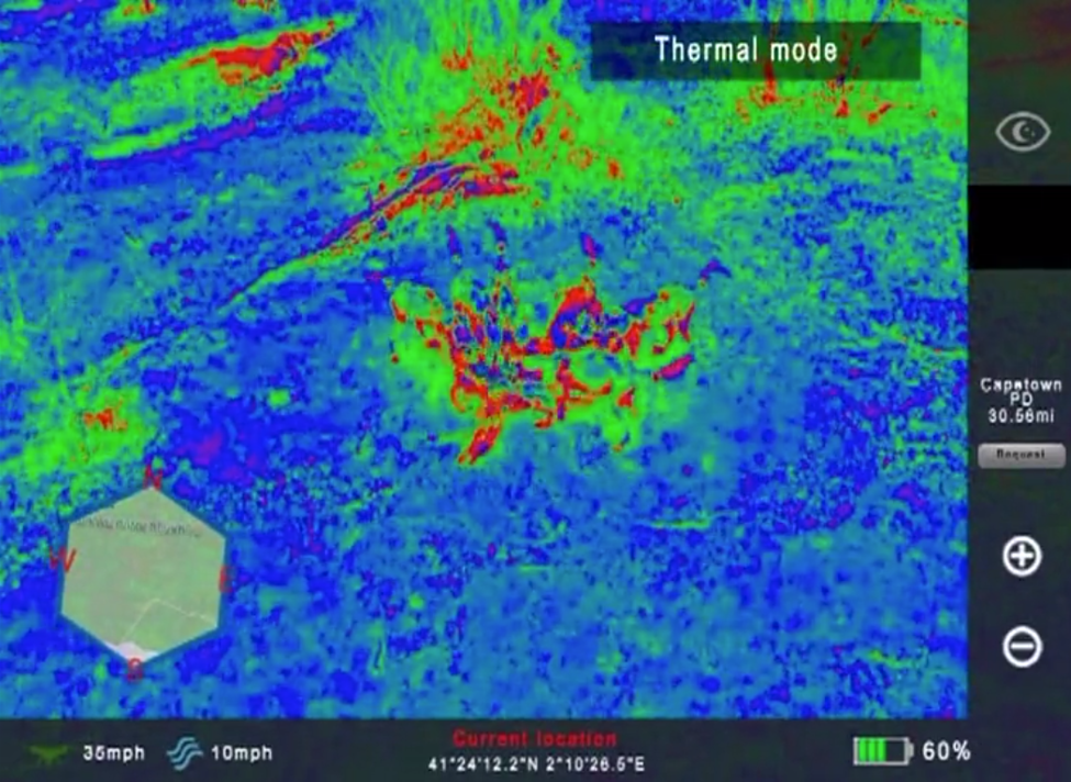
These drones are equipped with video cameras which relay information in real-time to park rangers and are proving invaluable in the hunt for poachers. Poachers often make fires to cook the bush meat they have hunted, the smoke from those fires can be detected from miles away with the high definition cameras equipped on all drones. This information can then be sent to law enforcement and increase the likelihood or an arrest.
Another important application for a park monitoring drone is map-making. These maps are providing the most up to date information therefore allowing conservationists to bring their cause to local governments and outside donors to gain much needed funding for their efforts.
From my research, I learned that although drones are being used with video cameras to create maps and for real-time surveillance footage, the processing and analysis of the footage by rangers and law enforcement officers is both time-intensive and error-prone. In addition, although this video surveillance can lead to the identification of poachers, there is a need for up-to-date information on vehicle registration, park borders, criminal records, and wildlife inventory.
I decided to create a concept for drone interface technology that uses drone video capture, paired with paired with interactive augmented reality, GIS technology, and facial recognition and vehicle identification capabilities.
Drone Interface concept